 Accueil Accueil
Notice
Histoire
Rôle(s)
Catégories
Liens
GpsPasSion
Versions
Bibliographie
Gargantua
Les Fées
|

 France - Dolmen de Flouirac [DLFLOU] France - Dolmen de Flouirac [DLFLOU]
|
Les 30 sites les plus proches :
| Distance | | ID Site | Photo | Description | Commune
(Département) | Ville proche |
|---|
|
| 0 Km | | DLFLOU+3 | 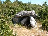 | Dolmen de Flouirac
Ostalet de la Fada | Montdardier
(Gard) | Vigan |
| 0,4 Km |  | MSCAMP+1 | .JPG) | Menhirs de Campouillas
| Montdardier
(Gard) | Vigan |
| 0,5 Km |  | DLCAUC+2 | 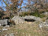 | Dolmen de la Caucalière
| Montdardier
(Gard) | Vigan |
| 0,5 Km |  | MHCAUC+1 | 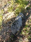 | Menhir de Caucalière
| Montdardier
(Gard) | Vigan |
| 1,3 Km | | DLBAR4+3 | 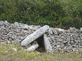 | Dolmen de Barral
| Blandas
(Gard) | Vigan |
| 1,6 Km | | DLTUD0+2 | 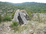 | Dolmen de la Tude
| Montdardier
(Gard) | Vigan |
| 1,6 Km | | MHTUDE+1 | .jpg) | Menhir de la Tude
| Montdardier
(Gard) | Vigan |
| 2,1 Km | | DLCAUG+3 | 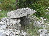 | Dolmen de Caucanas
| Montdardier
(Gard) | Vigan |
| 2,2 Km |  | LHLAC1+2 | 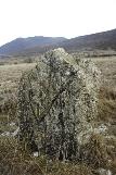 | Cromlech de Lacam de Rogues (A)
Camp de Pécou | Rogues
(Gard) | Vigan |
| 2,2 Km |  | MHLAC0 1 | | Menhir de Lacam
| Rogues
(Gard) | Vigan |
| 2,4 Km | | DLREG0+2 | 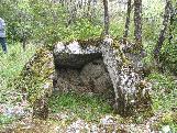 | Dolmen de Regos
| Blandas
(Gard) | Vigan |
| 2,4 Km |  | TPMON0-- | | Montdardier
| Montdardier
(Gard) | Vigan |
| 2,5 Km | | MHBOIO+1 | .jpg) | Menhir du Camp de Boissière
| Rogues
(Gard) | Vigan |
| 2,5 Km |  | DLCIS0+1 | 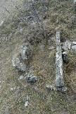 | Ciste de Lacam
| Rogues
(Gard) | Vigan |
| 2,5 Km |  | LHLAC2+1 | | Cromlech de Lacam de Rogues (B)
| Rogues
(Gard) | Vigan |
| 2,6 Km |  | FOBLAC-2 | 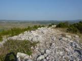 | Oppidum de la Blacarède
| Rogues
(Gard) | Vigan |
| 2,7 Km | | DLDASS+1 | .jpg) | Dolmen du Château d'Assas
| Blandas
(Gard) | Vigan |
| 3 Km |  | MHPLA4+3 | 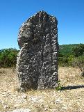 | Menhir de Planas
Serre de la Gleisa; Gleyze | Blandas
(Gard) | Vigan |
| 3 Km |  | MHTRIV-3 | 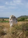 | Menhir de la Trivalle
| Rogues
(Gard) | Vigan |
| 3,2 Km |  | LHPLA0 1 | | Cromlech de Planas (B)
| Blandas
(Gard) | Vigan |
| 3,2 Km |  | MHPLAM-1 | | Menhir de Planas (A)
| Blandas
(Gard) | Vigan |
| 3,2 Km |  | DLPLA5+4 | 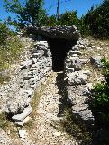 | Dolmen de Planas
| Blandas
(Gard) | Vigan |
| 3,3 Km | | DLBOR8+2 |  | Dolmen de la Borie d'Arre (C)
| Rogues
(Gard) | Vigan |
| 3,3 Km | | DLBOR7+2 |  | Dolmen de la Borie d'Arre (B)
| Rogues
(Gard) | Vigan |
| 3,5 Km | | DLBOR2+3 |  | Dolmen de la Borie d'Arre (A)
| Blandas
(Gard) | Vigan |
| 3,5 Km |  | LHPLAN+5 | 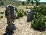 | Cromlech de Lacam de Peyrarines
Planas | Blandas
(Gard) | Vigan |
| 4,2 Km | | DLSOTC+1 | 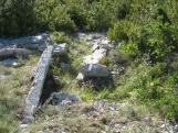 | Dolmen du Sotch de Gardie
| Rogues
(Gard) | Vigan |
| 4,2 Km | | MHSOTC+1 | 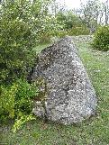 | Menhir du Sotch des Genièvres
| Blandas
(Gard) | Vigan |
| 4,3 Km | | MHTRA2+1 | 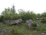 | Menhir du Travers des Noyers
| Blandas
(Gard) | Vigan |
| 4,4 Km | | MHLAV0+1 | 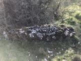 | Menhir de la Lavagne
| Blandas
(Gard) | Vigan |
| 4,9 Km | ") | MHLESCX0 | | Menhir de l'Escoutet
| Gorniès
(Hérault) | Vigan |
|
|
| © 2004-2024 T4T35 - Version du 3 décembre 2020 22:31 - Email : T4T35 |
|

 Belgique
 Ecosse
 France
 Irlande
 Pays de Galles